Eco Pressure [172]


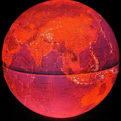
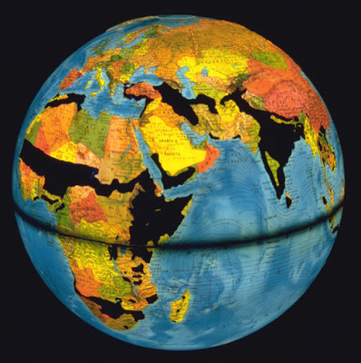
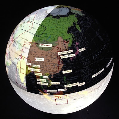
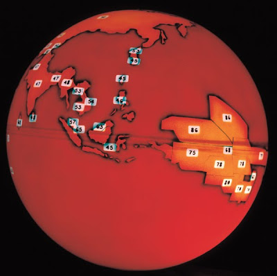
Arable land vs. population size: Some areas are particularly endangered and more sensitive to ecological imbalance. Population pressure, the scarcity of arable land, soil quality and climate set strict limits to growth.

US Patent Holders [284]


This globe represents half of all patents in the US - those registered to
foreign holders. Countries with more than 1000 patents registered in
the US are indicated by name, with the point size of the representative
text scaled according to the square root of the total number of US
patents held. Japan accounts for roughly one third of foreign-held US
patents, followed by Germany, the UK, and France. Were the number
of domestically held US patents to be indicated according to this logic,
the entire surface of the globe would be covered. As of 2007 over half of all patents registered in the US are foreign owned.

Non-Competitive Elections [227 -2]


Highlighted areas indicate those countries that are democratic in name only. Dictatorships, communist states, and military states either ban popular elections, disregard their results, or hand pick the candidates. Minimal red tape indicates a flawed democracy, the median amount indicates hybrid regimes, and the most red tape indicates authoritarian regimes. Flawed or corrupt representative democracies often do no better at generating competitive elections.

Soil Degradation [169]


Soil degradation is brought on by several factors, mostly predisposition for desertification, acid rain, need for fuelwood and food needs which are beyond the soil's capacity to support. This globe shows only areas where the population’s food needs lead to overexploitation and subsequently to soil degradation.

Labor Migration [166]


This world is divided into richer and poorer countries. Highlighted countries are considered rich, as the personal income averages more than US $2,500/year. Anybody making less is part of the rest, the poor. Accordingly, there is a migration from poorer to richer countries. Inconsistent definitions of labor migration, and the untrackable nature of illegal migration has resulted in a scarcity of data on the subject. Arrows shown represent flows of at least 50,000 migrants in a given year between 1986 and 2003 as noted by the International Labor Organization.

G8 vs. G20


The G8 states derive their global claim to leadership from their by now shrinking portion of the global economy (approx. 45% in 2009; 65% in 2002) which is represented here as the light part of the northern hemisphere. the G20 countries, which incorporate all G8 members, represent 85% of the world economy (southern hemisphere).. the portion of the world economy each member country controls is shown in a box surrounding each country; black outlines are G8 countries, red outlines are G20 members. red dots indicate membership in either G8 or G20; countries not represented are joined by dotted lines.

Forest Fires [159]


In spring 1998 uncontrolled forest fires raged in the equatorial regions. Airplanes crashed in Indonesia, Smoke plumes reached across national borders into other countries and even continents. One day the loss of forest the size of Belgium in Brazil was reported. El Nino was generally blamed for the lack of rain.

Earthquakes and Tectonic Plates [121]


There are eight major and many minor tectonic plates. These plates move in relation to one another at one of three types of plate boundaries: convergent, or collisional boundaries; divergent boundaries, also called spreading centers; and transform boundaries. Earthquakes, volcanic activity, mountain-building, and oceanic trench formation occur along plate boundaries. The lateral movement of the plates is typically at speeds of 50–100 mm annually.

Nuclear Non-Proliferation [178]


Checkmarks indicate signatories to the treaty. India, Pakistan and Israel did not sign the treaty. North Korea withdrew.

Mobile Teledensity [327 - 4]


Density of black lines indicate the penetration of mobile phones where more than 10% of the  population own one. Sparse lines represent less than 50% ownership, semi-concentrated  50% to 100%, and most dense indicate more phones than inhabitants. Countries with more than double the world's average growth rate (CAGR) of 23% from 2002 - 2007 are encircled with bright dots. There are 4 billion mobile phones, 3 times the number of landlines.

Japanese Economic Continent [21]


If landmass equaled wealth and economic might, Japan would occupy this much of the globe for most of the 1990s.
And due to a strong yen the picture looks largely unchanged today.

OZONE Hole [29-2]

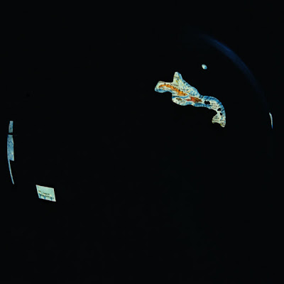
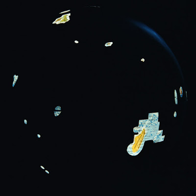
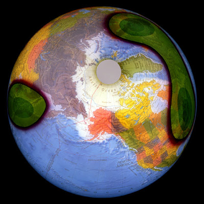
A second permanent ozone hole was detected in the area of the North Pole in 1990, producing radical meteorological changes in parts of the Northern Hemisphere. In 1996, the World Meteorological Organization (UNO) measured the Southern Ozone Hole to be the size of the US and Canada combined. They are expected to increase in size until 2020.

Ocean Upwellings [79]


Areas where colder, nutrient-rich, and biologically productive subsurface waters are brought to the surface. Phytoplankton thrives in these conditions and are at the base of the oceanic food chain. Therefore these are the biologically most productive areas. A combination of winds, currents, the Earth's rotation, shorelines and shallow bottoms induces upward and downward water movements. There are coastal upwellings as well as equatorial upwellings.

Acid Rain [80]


Acid rain is primarily caused by sulfur and nitrogen compounds that are released by factories, cars, and especially coal power plats. The emission can be carried hundreds of kilometers to effecting ecosystems in other countries. Acid rain has harmful effects on plants, aquatic animals, and infrastructure.

Ring of Fire [87]


Fault Lines and Earthquake Epicenters M>5 (larger than 5 on the Richter-scale).