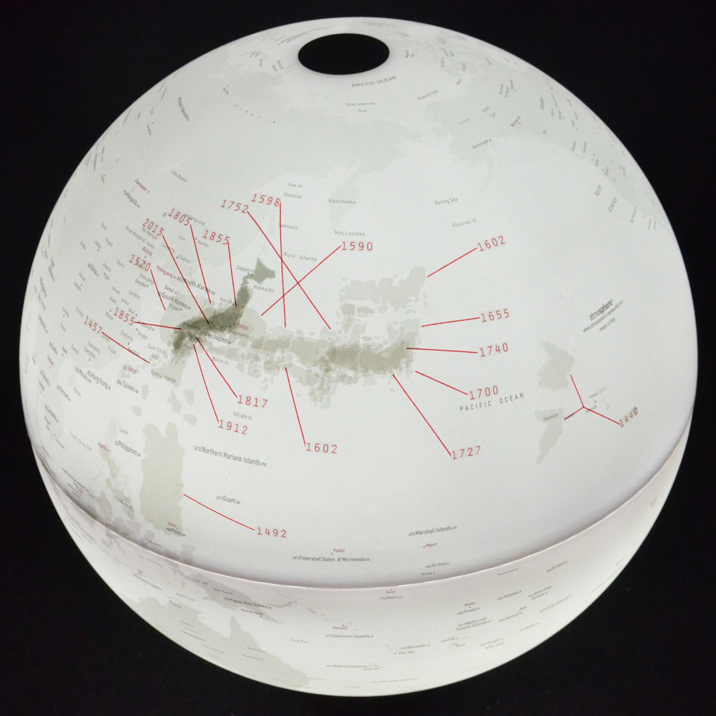
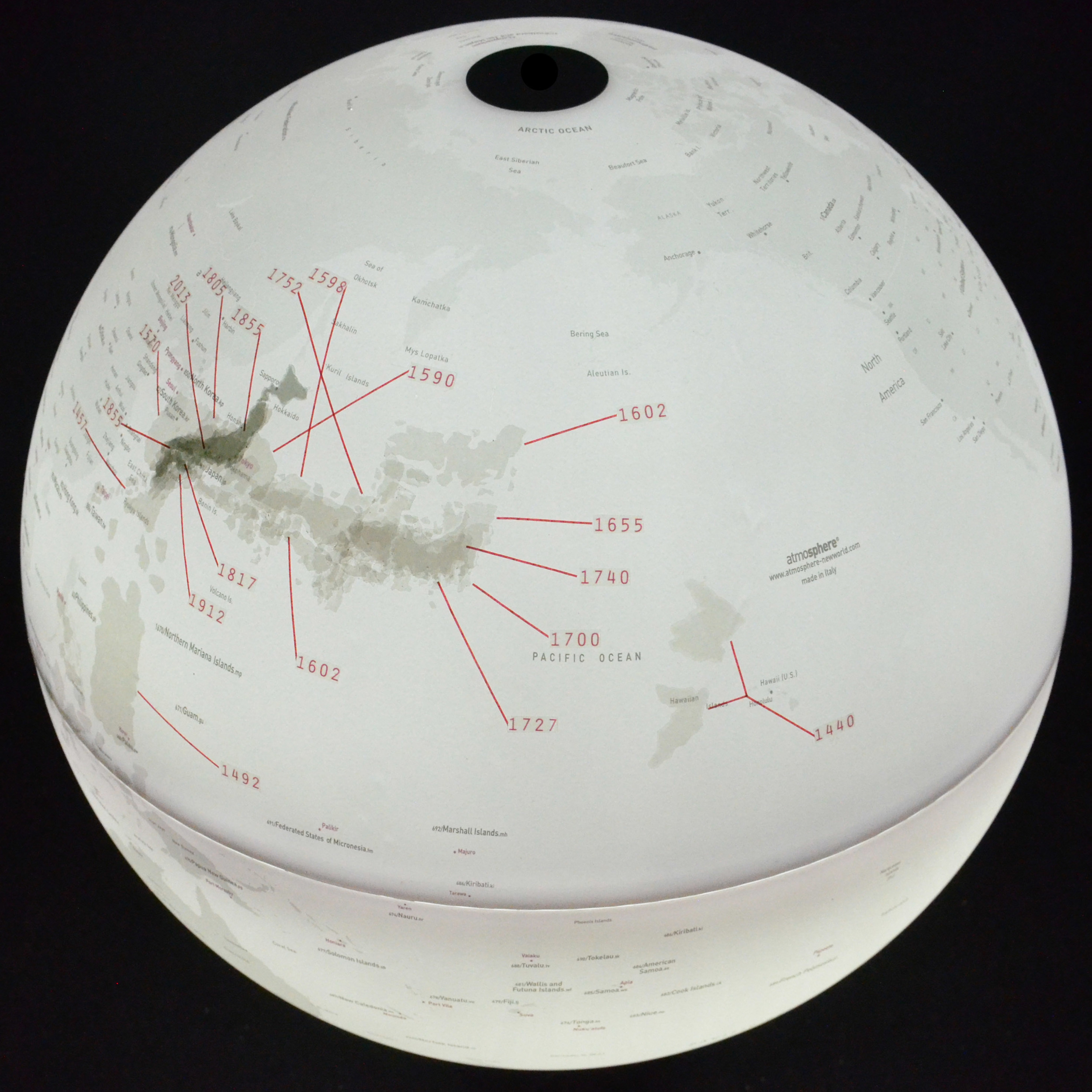
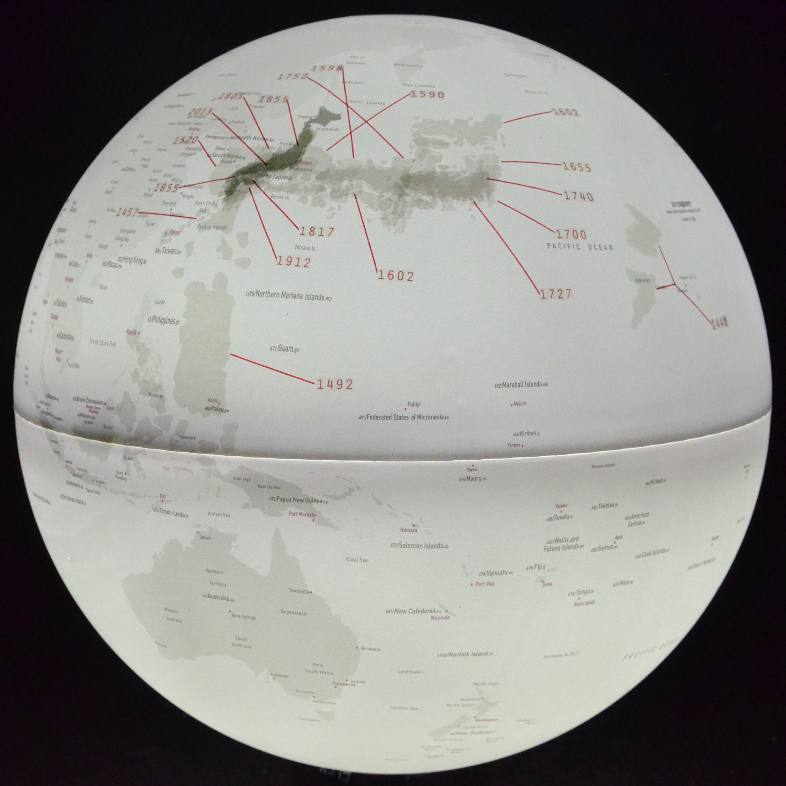
[389] Japan's Cartographic Development, 2013
20 cartographic representations of Japan dating from 1440 through the present are shown, illustrating the various shapes, sizes, and locations that were attributed to the country during this time. Despite the variety of these representations darker areas show increasing cartographic accuracy, especially over the course of the 18th and 19th century.